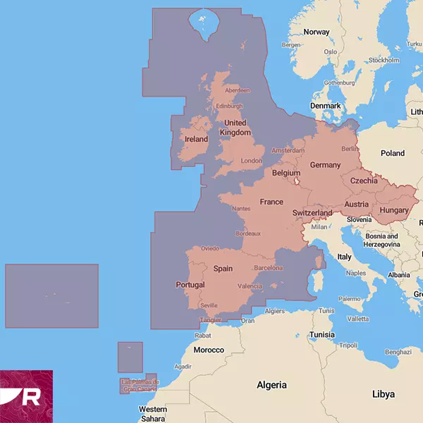
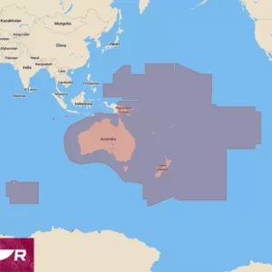
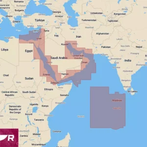
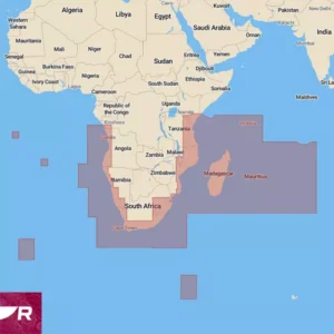
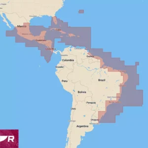
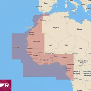
Raymarine Lighthouse Nautical Charts (mSD), West Europe covers Western Europe, including Ireland, Great Britain, Portugal, Spain, France, Germany, Switzerland, Austria, the Netherlands, Belgium, the Czech Republic, Hungary, and Slovakia. These charts are based on data from official hydrographic sources, converted into Raymarine's own format. The advantages of the new chart software include exceptional clarity, increased functionality, and improved imagery. Raymarine Lighthouse Nautical Charts are suitable for devices using the Lighthouse 3, 4, and 5 operating systems, including the Axiom, Axiom+, Axiom Pro, Axiom2 Pro, Axiom XL, Axiom2 XL, and Element series. Please check if your devices are up to date. The minimum update software .iso files required to display the Lighthouse nautical charts are already present on the memory card. If your devices have been updated, you can delete the software-containing files from the memory card.
See Raymarine
Teave laevateede kohta. Raymarine equipment software is available for free download. Before updating the software on your chart plotter or other navigation equipment, please read the guide on how to do so.
Software update at your own risk.
Raymarine LightHouse chart users can choose between four different display modes: Day, Twilight, Night, and Bright Sunlight. All of these modes are designed to enhance overall clarity and reduce eye strain in varying light conditions. Without altering the overall chart size, Lighthouse charts allow for adjustments to the size of buoys, lights, and other navigational icons. The level of detail displayed on the charts can also be adjusted, from showing only the primary navigational aids (Low) to including other objects to varying degrees (High).
The source data for cartographic objects is sourced from recognised marine information providers, Reeds Almanac and Marinas.com. To make the most of this information, Raymarine has included a “Find Nearest...” feature with preset options that will guide you directly to the nearest marina, fuel dock, anchorage, repair yard, or beach. One very useful feature for which more advanced information will be available in the future is true tidal height and currents, which Raymarine is currently working on. Satellite imagery for the LightHouse charts is provided by Mapbox and can be added or removed as layers to cover just land, or both land and sea. In addition to visual appeal, where you can see the surrounding area in vivid photographic detail, down to individual streets, buildings, and parks, this is also a great way to avoid shallow depths and reefs.
It's possible to choose between pro and leisure presentation modes; the first is S-52 (Government Chart Style), a chart mode favoured by professional mariners for its very clean and comprehensive marine information, and practically devoid of any land information. The second is a more colourful and information-rich version that leisure boat owners can use to find ports, shops, and other points of interest.
There are two additional features, the first of which is designed primarily for fishing enthusiasts. This includes fishing areas checked by experts, which display detailed fishing information for different species, from the best spots, along with additional information, one-metre interval depth contours, and RealBathy mapping capabilities. This allows users to create their own sonar maps of uncharted areas using their fishfinder.
A further very useful feature of the LightHouse Chart is available when using the Raymarine Premium service, which allows plotter charts to be updated via a smart device. The Premium package also provides access to enhanced satellite imagery and a large, constantly updated database of points of interest (POI). This offers up-to-date information about marinas, fuel stations, boatyards, repair workshops, as well as nearby shopping centres and restaurants. The locations of Raymarine service points are also marked.
Changing the size of chart symbols independently of the zoom level. Without altering the overall size of the nautical chart, it is possible to change the size of, for example, buoys, lights, and other navigational icons. It is also possible to adjust the level of detail displayed on nautical charts, limiting it to only the main navigational aids (low) or adding less important points of interest to varying degrees (high).
QUICK START GUIDE: Thank you for your interest in Raymarine LightHouse Charts. The new chart needs to be downloaded and copied to the memory card directory supplied in the package. lighthouse_charts. To download the map, go to Raymarine ChartManager and create an account for yourself. Once you have opened the card packaging, you will find the card VOUCHER CODE. Select the command from the ChartManager homepage: Redeem your voucher, enter the correct code and press Submit. Follow the on-screen prompts. Map WEU You have already been selected and you can add to your choices in two categories: Point of interest, What are the streets and points of interest and Aerial, what is satellite view. In both categories, you can drag squares onto the map in the areas you wish to download. You can select four squares for each category; please make your selection reasonably. Once you have made all the necessary selections, the approximate file size will be displayed, and you should press the button Download. You will now be asked to enter your LightHouse card ID. Navigate to your new memory card in the search window and select the file named lighthouse_id.txt Your downloadable chart will be associated with this memory card going forward, please keep the packaging in a safe place and do not lose the memory card. Downloading will not happen instantly; depending on your selections, the server will prepare your downloadable LightHouse chart file. This will take time depending on the size, which can range from 1.9GB to 20GB with all extras. Do not close your browser or computer during the download; the chart file will be automatically downloaded to your computer's Downloads folder, and from there, copy it to the folder on the memory card. lighthouse_charts Check before copying, and the download is finished and the map file name is lighthouse_chart.rmc NB! Do not change the file name or type!